Rock Island State Park
We packed up and traveled to Rock Island State Park in Tennessee
In late February, we took our last winter trip of 2024. We packed up our camper and the dogs and traveled to Rock Island State Park, located in Rock Island, Tennessee. The following article is longer than we typically post, because we went on three different hikes over the period of four days. I will also be talking about our experience camping at Rock Island. Don’t click away though – this article is a helpful hiking guide!
On Monday, we drove about three hours north to Rock Island State Park. The town of Rock Island is very small and rural, with lots of farmland. Rock Island is not close to the interstate, and you actually drive through a lot of curvy roads through farmland to get there. It seems like state parks in Tennessee are spread out and you have to drive to different parts of them. This is the case with Rock Island, but it is no big deal! It is definitely worth driving the short distances to the other parts.
Rock Island State Park Hikes
Downstream Trail
There are 12 different trails at Rock Island State Park. The longest one is 2.65 miles, and some of the trails are connector trails. Rock Island State Park is located along the banks of the Collins River and Caney Fork River. On our first full day at the park, we drove from our campsite, through the park, back through the town of Rock Island, across the Caney Fork River, down a windy and narrow farm road (Powerhouse Road) to get to the gravel lot for the Twin Falls Overlook and Downstream Trail.

Twin Falls is an 80 feet tall waterfall that is located on down the Caney Fork River. This waterfall is huge, and when you Google the park, this will probably be in the top search results. Once you park at the trailhead, you don’t have to travel far at all to get a good look at the falls. You can see the waterfall from the parking lot, but if you want to get a better view, I suggest walking a little farther down the trail until you see a large red sign that says:
DO NOT SWIM IN THIS AREA
SWIFT CURRENTS
RAPIDLY RISING WATER
STAY ON MAIN TRAIL
This sign makes it look like you can’t walk down to the water, but you can. There is a marked trail that leads you close to the water and gives you awesome views of Twin Falls. But, just as the sign says, you need to be on the lookout for rapidly rising water. This is because there is a dam on the river located at the front of the park, and hikers need to be wary of water releases.
After hiking along the river, the trail goes uphill just a little. The entire Downstream Trail follows closely along the river, and gradually takes you higher and higher above it. This trail also has three shallow water crossings. When you get to the first water crossing, look to your right. You should see a waterfall! If you walk up the hill to the waterfall, there are steps to allow you to get right up next to the waterfall. The small waterfall also flows in front of a cave. We walked around in the cave and walked behind the waterfall. This was a neat experience, and we weren’t even a entire mile down the trail!
As you continue down the trail, you get great views of the river, other waterfalls that empty into the river, and rapids. While we were on this trail, we saw great blue herons, a green frog, and a dusky salamander. This trail is only 1.55 miles and lollipops at the end. Once you get to the farthest end of the trail where it starts to turn back on itself, look for blue markers leading away from the white marked trail. If you follow these markers, it leads you down to a beach area on the river. Definitely worth the little detour! Overall, the Downstream Trail was very easy. The most challenging part was the final stretch off of the trail because it is uphill back into the parking lot. This trail is a must if you are visiting the park!
Blue Hole Trail and Eagle Trail
On Wednesday, we drove a short distance from our campsite to the Blue Hole Trail. When you are driving through the park, the road for it is marked as “Blue Hole Picnic Area 3.” There is a large picnic area and bathrooms located at this trailhead.
The Blue Hole Trail is unlike anything we have ever hiked
The Blue Hole Trail is unlike anything we have ever hiked. First of all, it is only .15 miles and there is a sign that says it is strenuous and to use extreme caution. I am normally not a fan of trails marked “strenuous” (cue my PTSD flashback to the Waterfall Trail at Cloudland Canyon State Park). But if you have waterproof shoes and you pay attention to where you step, you have got to check this trail out!
At the top of the trail, you walk downhill just a little way, and then you will come up to a staircase. The staircase ends in a waterfall. Literally. After getting a little wet, you will turn left and walk across a metal grate that stays close to a rocky cliff. You will then travel down another metal grate with wooden block stairs, a railing, and a cable. At the bottom of this, it seems like the trail dead ends. Actually, if you look around, you will see that the trail walks through the waterfall. The waterfall forks in different sections down the cliff, and then flows off of a cliff below the trail and into the Caney Fork River.

This trail gives you an opportunity to explore a beautiful creek environment. It was not very slippery at all, most of the waterfall/creek bed was pebbles. The water was not very deep either, but I would definitely wear waterproof hiking boots because you will be hiking in and out of the water. We also found so many salamanders while we were on this trail! We spent a long time exploring this area. This trail was so pretty and so unexpected!
After we were finished hiking around Blue Hole, we went back up the staircases to the Eagle Trail. This trail is only .75 miles. Its trailhead is right next to Blue Hole’s trailhead, so you do not need to drive to get to it. This trail is also Rock Island’s Arboretum Walk. Along this trail, native trees of Tennessee are marked along the trail. This hike is very easy and is a great way to learn about different trees in the area. The Eagle Trail ends with another blue marked trail. If you follow this very short trail, it leads you to another waterfall overlook! This waterfall flows through carved rock into the river. In the photos attached to this article it is hard to understand just how tall the waterfall is. This view is definitely worth the extension to your hike!
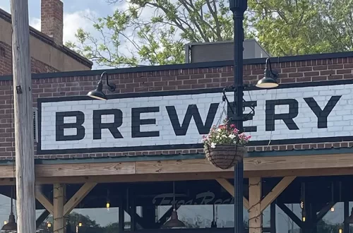
Thursday was a rainy day, so we drove to Happy Trails Brewing Company in Sparta.
Collins River Nature Trail
Friday morning, we were going home, but we still wanted to get one more hike in before we went back to Georgia. We picked the Collins River Nature Trail, which follows along the Collins River and through the surrounding woods. This trail in total is 2.65 miles. However, if you want to cut it even shorter, you can take the Cunningham Connector Trail and subtract .8 miles from your hike. We did this since we were on our way home.
This hike was mostly through the woods. Parts of the hike were through power line areas. In these spots, we found a lot of deer tracks and coyote poop! Watch your step along this area! Although this trail is pretty, signs at the beginning of the trail say that it is even prettier in the spring/summer because of its abundance of wildflowers. This is a great trail to make your pups sleepy!
Other Trails and Spots at Rock Island State Park
One can’t miss area of Rock Island State Park is Great Falls. You do not have to hike to see the Great Falls area of the Caney Fork River’s rapids. There is a parking lot to the left of the historic cotton mill that is located at the park. From here, you can walk to an overlook that gives a great view of the Falls. Explore this area, too! There is a historic Spring Castle and information about the old cotton mill and the town that used to be located in this area.
We found a few Secret Spots at Rock Island State Park
Another secret spot we found was at Area 2, which is labeled “Picnicking & Playfield No. 2” from the road. If you are driving on the road that the visitor center is located on, then it is after the tent camping area and before the Blue Hole Area 3. When you go into this area, drive all the way to the back. You will pass a few playgrounds and a pavilion. But in the very back of the parking lot is a sign for a viewpoint. Park and go see it! This area gives you a high up view of the Caney Fork River.

Camping at Rock Island
Rock Island has two separate campgrounds. One for campers/RVs, and one for tent camping. We stayed in the camper/RV area. The campground has one section closed off for the season. When we first got to the campground, the first thing we noticed was how empty it was. When we first checked in, there were only two other campers there! This was not a negative at all! It is just something we have never experienced before. I think it was so empty because it was late February during the week – not necessarily a popular camping time.
We stayed in site #12. This site was on a cul-de-sac. We were downhill but a short walk from the bathhouse, which was kept pretty clean throughout our stay. The campsites had paved camper parking. We had a spacious side area with a picnic table and fire pit. One of the reasons we picked this site is because we had a lot of space right behind our site that was nice for walking our dogs.
Wi-Fi is available at the campground and actually works.
We were able to ride our bikes around the campground and cabin loop. There is also a playground and pavilion located in the campground. The tent campground only has 10 sites, and the camper/RV campground has 50 sites, but only 20 sites are available year-round. We got lucky that it didn’t get too cold during our stay, but if you are looking for some great winter camping, then check out Rock Island!
Tips for your trip to Rock Island State Park
- Waterproof hiking boots are your best bet for hiking at Rock Island.
- A good spot to watch the sunset is at the trailhead of the Collins River Trail. You can catch part of the sunset over the river and before it goes behind the trees!
- If you camp during the off season like we did, be sure to bring a few flashlights. The campground is really dark at night, but when you are the only person on your campground street, it feels even darker! And if you want to up the creepy factor, listen to a scary story podcast around the campfire.
- The campground has Wi-Fi! And it actually works!
- Rock Island is a rural community. In the small town, there is the Rock Island Market, which is a gas station. There is also a large fishing tackle section there. There is also a restaurant there with cheap and good food! There is a Dollar General about five minutes away from the park. The visitor center sells ice.
- Rock Island is a great park for families. There are many different picnic areas. We also counted at least four different playgrounds.
If you want something more rugged after Rock Island’s waterfalls, the North Chickamauga Creek Gorge hiking trails deliver rocky creekbeds, swimming spots, and a true backcountry feel close to Chattanooga.
Rock Island State Park
82 Beach Road
Rock Island, TN 38581 (Google Map)
tnstateparks.com/parks/rock-island
GPS Coordinates: 35.8093 | -85.6419
Last Updated on January 13, 2026